
South Chadderton - What’s there to talk about?
From: Metrolink Insights (Series 3: 12) South Chadderton tram stop and (Series 2: 10) The Remains of the Oldham Loop Part 1/2
South Chadderton tram stop is on the Rochdale Line, and it’s between Hollinwood and Freehold. It lies on a railway line: The Oldham Loop, converted to Metrolink between 2009-2012.
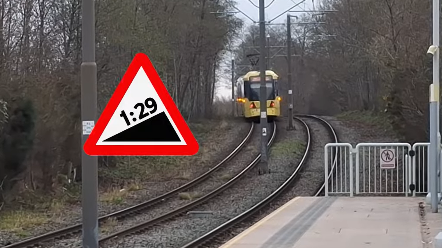
One of the steep inclines at South Chadderton, looking towards the south of the tram stop.
At South Chadderton, you’ll notice two steep inclines uphill for trams at both sides of the stop at a grade of 1:29.
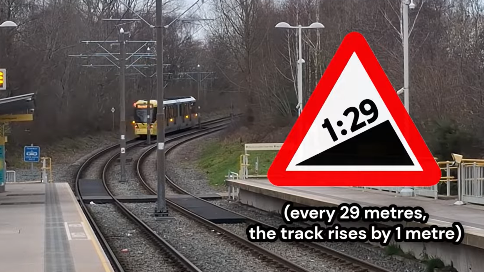
The other steep incline to the north of South Chadderton’s platforms.
This is odd since the railway was originally opened here in 1880, and trains from back then were not capable of traversing steep inclines like what you see at South Chadderton today very easily,
and even then the steepest passenger railway incline in the country was 1:27 (it was quite close by: a few miles further north in fact, till the line was closed in the 1960s), so surely a 1:29 incline like the ones at South Chadderton would have been noted down, and yet I found no mention of it anywhere. So my theory (which I’m quite sure is correct) is that during Metrolink conversion, the railway’s height was lowered between the Drury Lane and Stanley Road bridges south and north of the tram stop respectively. The original alignment was above street-level, which meant that if a new tram stop were to be constructed here, it would need to be above street-level as well of course. Building a stop at this elevation might have caused problems with accessibility in the future, for example a lift to the platforms going out of service. Plus disabled-access ramps, though a more permanent and much cheaper feature, would not only be less convenient for passengers, but is also much less feasible than just lowering the level of the tram line for a brief section down to street-level, making both constructing and using/accessing the tram stop much easier.
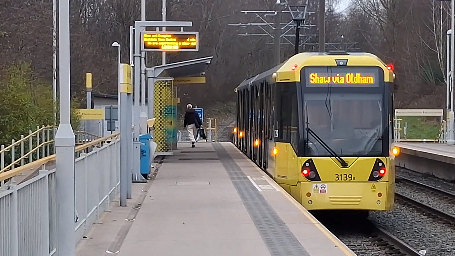
Shot of a Shaw via Oldham bound tram at South Chadderton.
A similar change was also done at Newbold tram stop further north up the line towards Rochdale.
The line wasn’t brought all the way down to exactly street-level (meaning where the original ground level was), made clear by the footpaths to the tram stop rising up slightly approaching the foot crossing. Before the railway was lowered, there used to be an underpass under the railway for pedestrians. This was obviously removed when Metrolink came along. There are no available images of this particular underpass, but historical maps of the area show its existence. The roads closest to South Chadderton and the houses built with them are new, and as a result don’t have recent street view coverage on Google Maps, either.
Both of the present day inclines are noted on overhead line masts as being 1:29. If this is correct, we can calculate the average gradient of the original railway line here after doing some maths and measuring distances on Google Satellite View (measuring from 5m north of Drury Lane to 5m south of platforms = 168m, then from 5m north of foot crossing to 5m south of Stanley Road = 297m, I left 5m of margin for the incline to begin as it doesn’t start immediately at the ends of the road bridges). I calculated the rising gradient between the Drury Lane and Stanley Road bridge by measuring the total distance between 5m north of Drury Lane and 5m south of Stanley Road = 542m… so 297/29 minus 168/29 = 10.24 - 5.79 = 4.45m of difference in elevation between the two bridges. Total track distance between the bridges is 542m, divide 542m and 4.45m to get the rising gradient towards the north of approx. 1:122, the average gradient of the original railway line at this particular section between the bridges.
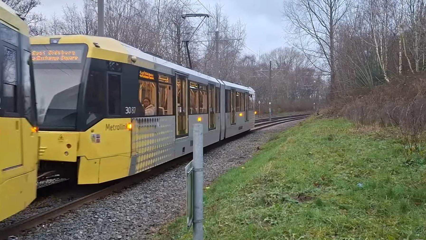
View looking north from the foot crossing. A tram towards Manchester approaches.
Also at South Chadderton you’ll see cleared vegetation to the right-hand side of the tracks past the foot crossing. This is probably to provide extra visibility for drivers on the approach to South Chadderton heading towards Manchester, as they will be trailing past a foot crossing of course.
There are already speed restrictions in force (30mph at the top of the incline at the Stanley Road bridge, and 20mph on the approach to the foot crossing), but the trees migt have been cleared for extra safety.
Next up, at the north end of the platforms, there are two exits for passengers: two footpaths, one heading west and one heading east.
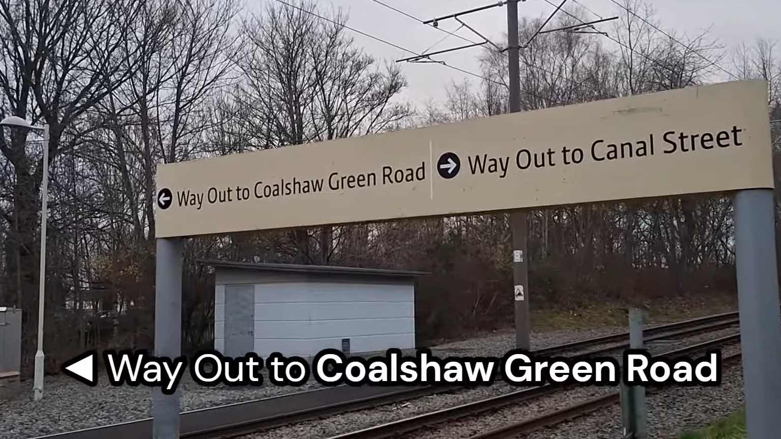
Way Out sign on the Manchester platform side.
On the Manchester platform side, the two exits are noted as
“◀ Way Out to Coalshaw Green Road”
“Way Out to Canal Street ▶”
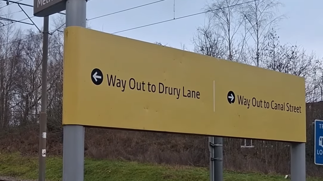
Way Out sign on the Rochdale platform side.
On the Rochdale platform side, they are noted as
“◀ Way Out to Drury Lane”
“Way Out to Canal Street ▶”
The left facing exits are pointing to the exact same footpath and the exact same road, but for some reason the two signs can’t agree on which name to give the road.
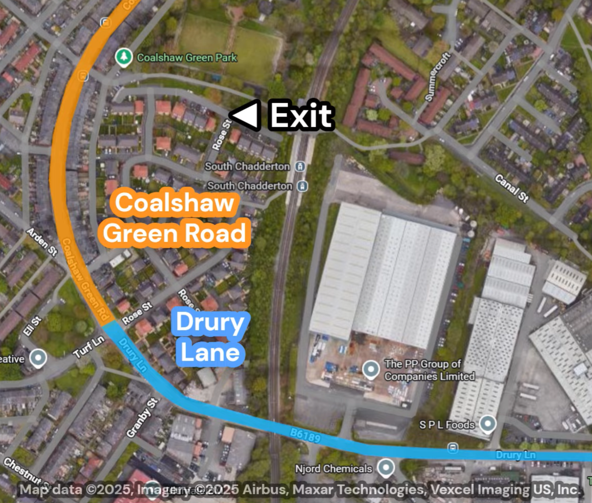
The footpath leads up to Coalshaw Green Road, which makes the Manchester platform exit sign correct, however if you follow the road further south, after a few hundred metres it becomes Drury Lane, which doesn’t fully explain why there are two exit signs pointing to the same road giving two different names for the exit.
There are disabled access ramps to each platform from this footpath, but behind the Rochdale platform is a low-key entrance from Rose Street that is not signposted as an exit at the tram stop.
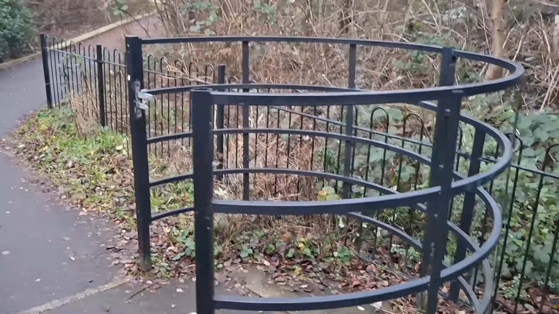
A picture of the kissing gate on the short footpath to the Rochdale platform, added ~2021?
Also on this short footpath is a circular gate called a kissing gate, and weirdly, it was added to the path between 2019-2022 quite recently. I have no idea why this feature was added. These gates are seen elsewhere around the area: there’s another one on the footpath running south of Coalshaw Green Park.
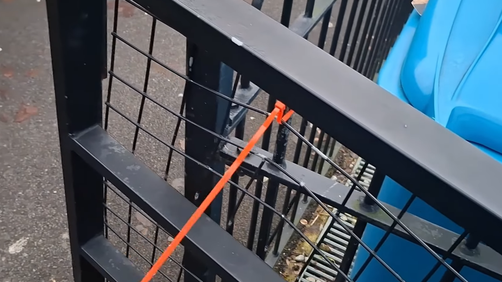
Orange zip tie holding the gate open.
The actual gate for it has been held open with a zip tie. Also weirdly enough, this part (the part of the gate that actually opens) was only added here in around 2023-2024. It’s a mystery about this little gate.
North of the Rochdale platform are suspicious-looking concrete blocks in the ground. A look on Google Street View and you’ll find that bicycle lockers used to be in this spot in 2022, but one of them has been damaged by someone in the Street View image, which is probably the reason they were removed.
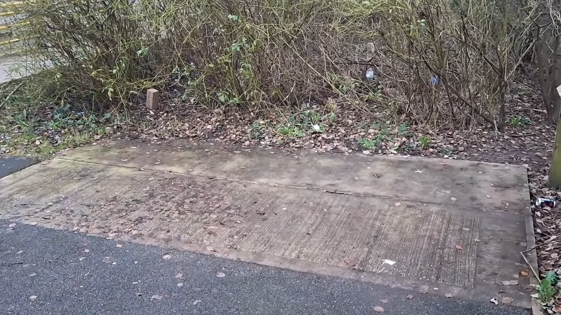
Concrete blocks where bike lockers used to stand.
North of the Rochdale platform are suspicious-looking concrete blocks in the ground. A look on Google Street View and you’ll find that bicycle lockers used to be in this spot in 2022, but one of them has been damaged by someone in the Street View image, which is probably the reason they were removed.
Who knew there was so much to say about South Chadderton?